This 28 mile Lucky Lake Loop was one I had discovered after I ran a search from returning from the Lucky Lake trip I did before. While the trail log and maps provided at Cascade Hiking Adventures definitely was a good reference, I did feel like the trail log could have used more detail at times. There were a couple of spots where I started to lose elevation gain or the trail split where I didn't expect it, as the changes weren't recorded on the website. Overall though their review definitely helped and I was able to screen shot the maps to pull them up on my phone en route. (I also had purchased an actual map from REI in Bend.) When I had hit the trail in April, there was minimal snow on the trail and the campsite that I had stayed at while car camping was completely empty. This time I planned to car camp at the same spot the first night and then spend two days completing the 28 mile trek. The original campsite I tried was packed with fisherman however so then I researched and drove over to another nearby camp area where I was able to find some open spots.
These are pictures from the camp location:


The next morning we were up and on trail by 8:30am. I'd had a solid breakfast with oatmeal and surprisingly both dogs actually ate. It's just over a mile up trail from the Senoj Trailhead to Lucky Lake. The total trail goes by MANY MANY lakes so I'm not including pictures of all of them :)

I would not be exaggerating if I stated that we climbed over, around or under over 100 downed logs on this trail. Apparently a pretty decent wind storm had come through the weekend before.

There was one section near Corral Swamp where there were so many downed trees that I completely lost the trail. I wandered around for a bit exploring the area and was also able to get a slight cell signal to pull up GPS and be able to see what general direction to head in. A bit of additional gut instinct and I refound the trail...after crossing through the swamp :)

After turning onto the next trail, we hit an area of pure sunshine. There was a side jaunt to an additional lake that we could have taken but I decided we'd just keep on going as we were already going to see so many bodies of water along the way.
About mile 9 or 10 we came across Boyd with his pack llamas. He asked if we would sit for a spell and chat and I always love meeting new people on trail. He has been traveling this trail for over thirty years and had some great stories. The original trail log mentioned camping at around mile 13, but I was able to ask Boyd about other options and he encouraged us to go on. Although he did share his secret camping spot and gave permission to use some of his stowed away goods at his lake about 11 miles in :)

He also told us about Muskrat Lodge. Years ago this was a great spot with mouse proof cabinets, an incredibly warming stove, and a sleeping loft. He talked about spending time in there warming and sleeping by the fire on snow shoe trips. It was sort of sad to see it in such disrepair now.

After his one pack llama started backing toward as as if he wanted to kick, Roxi almost got into it with his dog, AND Roxi almost sat on a snake, I decided it was time for us to move on. About two miles later, the dogs and I passed the lake where Boyd frequents and we took the side trail toward Snowshoe Lake.
This is a short pano of Snowshoe Lake, which is where the guide suggestions camping:

I kept checking mileage on the maps and seeing how the dogs and I were doing. Since we were in pretty decent shape (and I didn't see the point in stopping hiking til evening), we continued on til we made the Pacific Crest Trail shelter off of Cliff Lake.
This made a great little spot to set up camp:

Both dogs were pretty beat after 18 miles and scarfed down all their food. I had plenty of daylight to change into fresh clothes, set up the tent and sleeping gear, prepare hot cider to keep my body temp up, make some dinner, and then soak my blistered feet in the icy lake. I spent a few moments in my camp hammock and then crawled into bed to read for a bit. Roxi got to spend a few hours sleeping inside the tent for the first time ever, but she decided she likes it outside much better. :)
On Day 2 we headed out back on the PCT:

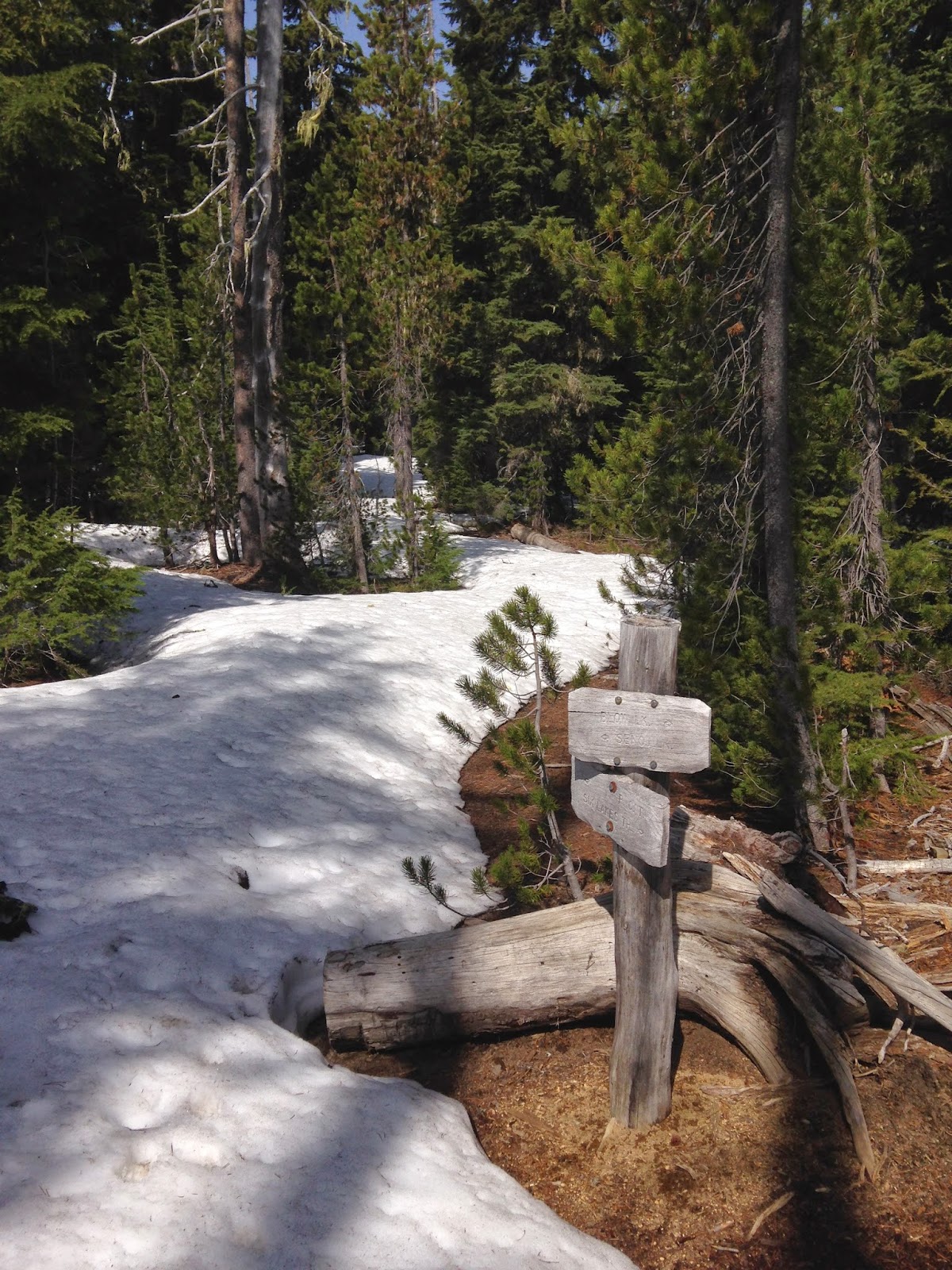
We passed several more lakes before starting to run into snow, even as we were dropping elevation. Interestingly we came across the worst of the snow banks about 4700-5200ft and once the final trail split off, it was a struggle to find the trail. This is the start of where the trail split and headed into even more snow:
There were a couple miles in here where I could hardly determine where the trail was and seriously had to start contemplating turning around in order to backtrack all 22 miles. (We only had six more to go.... but the trees on this trail aren't stamped nor marked like many other winter trails...) Eventually I was able to pick up a pair of slight footprints that you can see two pictures down. Someone had come through on this trail probably a couple days prior and knew where they were going. Thank the Lord....because backtracking 22 miles would have been horrible! This was also the moment when I realized that Reg D truly needs to teach me map & compass navigation.

Senoj Lake was beautiful!

The footprints! Woohoo!

Besides the initial mountain behind Lucky Lake, this is the only other decent viewpoint from the trail. This is at the highest point of the hike which is about 6000 ft.
From the viewpoint is a few more miles back to Lucky Lake. On the route from Lucky Lake back to the car we met another older gentleman who we chatted with for ten minutes. He advised that I just get a GPS rather than use the old map and compass system :)
The dogs ran straight to the car and jumped inside. They were happy to have more food and some additional water. I changed clothes, used the actual bathroom at the trail head, shoved an apple in my mouth, and then headed back to our favorite camp site to check my work email, soak my angry feet, and take in some great views. I contemplated spending another night here as most the fishermen had headed out....but decided to head back to the valley and work instead.


Altogether I learned a few lessons but was also really glad at how well the trip went overall. General rule of thumb is start with highest elevation first. I also figured out that drinking a hot beverage right after stopping mileage granted me additional moments of finger usage. I have Raynauds so once I stop moving and my core body temp starts to drop, I tend to lose sensation in my fingers for quite a while. I've learned to work around this by doing everything that I need to do with my fingers (changing, setting up the tent, getting dinner ready, getting fresh water, etc) within 10 minutes of stopping. The hot beverage trick granted me more time and I also noticed that I didn't lose sensation in all of the fingers this time. It was great! Besides compass skills, I also probably need to be in the market for new hiking shoes.
But altogether a pretty successful first solo excursion! And I didn't even have that on my goal list for this year :) Glad to be on trail with Reg D this weekend however!
I absolutely love that you did this! Being alone in nature is one of my most favorite things ever, and being able to completely check out for a few days - it is something I used to do more of. Of course now, my mama brain says "be careful!" I'm glad you were able to cross it off your bucket list :-)
ReplyDeleteSounds like an awesome trip! You are so brave to do this by yourself but it sounds like you've learned enough along the way from other camping trips to feel confident back packing by yourself! The pictures are beautiful!
ReplyDelete